The STK Esri Display Library ("the Library") allows developers to integrate Esri map documents and GIS functionality into custom STK X and STK Engine applications. It also allows for automation of GIS functionality in STK and manipulation of map documents from external scripts or applications.
With this capability the STK rendering and animation engine can directly open and visualize Esri map documents. This is accomplished by embedding the ArcGIS Engine into the STK 3D capabilities.
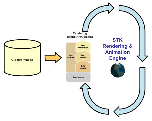
The Library is a thin wrapper on top of ArcObjects. It is functionally equivalent to the ArcGIS esriDisplay library, but for STK. It also exposes a few helper classes to facilitate configuration and manipulation of GIS data in the specifc context of STK and custom applications.
Using the Library the 3D visualization can ingest GIS data in its native format (i.e. without requiring prior conversion to a specific format). The native GIS information is processed on the fly, as the 3D view changes:
In both cases, the GIS data is rendered at the optimal resolution for the current 3D view. Follow this link for information on Best Practices for optimizing GPS processing.
The Library also provides:
STK Programming Interface 11.0.1