Creating a Video from Saved EOIR Images
EOIR Scene Visual Details
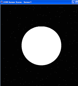
To display visual details about the selected scene, right-click the sensor scene and select Details... from the drop-down menu. The EOIR Scene Visual Details dialog box will appear in the Ansys Systems Tool Kit® (STK®) application, providing the information and viewing options described in this topic.
Scene Pick Information
Click a pixel in the Sensor Scene window to display its scene pick information in the dialog box. When you click a point in the target, the target object's relative azimuth and elevation appear. When you click a point source object, you will see a zero for these quantities because it is not resolved.
To reveal scene pick information for a different pixel, click that pixel and EOIR will update the scene pick fields in the dialog box.
The following table lists and describes the Scene Pick Information parameters in the EOIR Scene Visual Details dialog box.
| Scene Pick Information | |
|---|---|
| Field | Description |
| Object | Shows the name of the selected object or background; for help in locating the target object in the scene, see Verifying target is in field of view (FOV). |
| Distance | This is the distance (in km) from the EOIR sensor to the surface location of the selected object. |
| Catalog | Shows the catalog number of the selected star, based on the Star Collection selected on the scenario's Basic Database properties page. |
| RA | Shows the right ascension (in degrees) of the selected point for stars and space. This field becomes target azimuth (Tgt Az) from the perspective of the sensor for objects. |
| Dec | Shows the declination (in degrees) of the selected point for stars and space. This field becomes target elevation (Tgt El) from the perspective of the sensor for objects. |
| Longitude | Shows the longitudinal coordinate (in degrees) of the surface location. |
| Latitude | Shows the latitudinal coordinate (in degrees) of the surface location. |
| Temperature | Shows the thermal model temperature (Kelvin) of the surface location. |
| Material | Gives the material type of the surface location. |
| Scene Pixel X/Y |
Shows the horizontal and vertical coordinate of the sensor scene pixel, with the upper-left corner being 0,0. There are four times as many sensor scene pixels in each dimension as there are EOIR sensor pixels. |
| Tessellation | Database ID of the surface image tessellation; debugging information for programmers |
| Spectral Radiance |
Gives the peak spectral radiance in W/(cm2 um) coming from the point clicked to the EOIR sensor. |
| Inband Radiance | Gives the total band radiance in W/cm2 coming from the point clicked to the EOIR sensor. |
Color Map
Select from one of the following four color maps: Gray Scale, BGRY, Red 1, and Red 2. Selecting a color map enables various "false color" mappings of the display. EOIR uses false color to bring out details in the image data that are often lost when displayed on a monitor with less resolution than the EOIR sensor. For instance, a typical monitor can display only 256 levels of grayscale, whereas an EOIR sensor might have 4096 levels of grayscale resolution.
Color mapping is only for visual effect and does not change any of the internal data values.
Scene Detail
Scene Detail provides some control over the amount of calculation detail and therefore time to generate an image. Choose one of the following:
Coarse. Calculates scene detail to the spatial resolution of the tessellations.
Smoothed. Further calculations apply image interpolation algorithms that smooth off the edges of the tessellations.
Fine. Still further calculations overlay the tessellations of an object with a detailed surface map of materials, if such a map exists for the object. The Earth, for instance, has a surface material map of 0.93 km resolution.
Display settings
AGC. When you select the Automatic Gain Control check box, EOIR automatically calculates brightness and contrast such that the brightest scene detail fits within the brightness resolution of the monitor.
Lower Bound. If you raise the lower bound setting, the STK application raises the minimum value for a pixel's radiance/irradiance to show.
Upper Bound. If you lower the Upper Bound setting, the STK application lowers the maximum value of a pixel before pixel saturation occurs.
AGC or Lower/Upper Bound settings are only for visual effect and do not change any of the internal data values.
Automatic File Output
EOIR processes the raw sensor data or a scene bitmap based on the selected level (radiometric input, geometric input, or sensor output) for each animation time step. You can choose one or more of the following the options:
- Raw Sensor Data - save for each animation time step
- Scene Bitmap - save one for each animation time step
- Image Pixel Data - save data for all the pixels in the scene
- Pixel Spectral Data - save for each pixel pick
Images are saved as BMP files in the specified folder.
When creating automatic file output for each animation step, EOIR creates a new file with a file name that contains the corresponding time in epoch seconds.
The Pixel Spectral Data is available in the text file EOIR_ClickData.txt.
Raw Sensor Data file format
The Raw Sensor Data file has one line of text for each row of sensor pixels. Each line of text has space-separated pixel values, one for each pixel column. The units designation for pixel value depends on the setting of the sensor scene output.
Sensor Input Scene (Scene Bitmap) file format
The Sensor Input Scene file has two sections:
First Section
This section lists every scene generator pixel, one per line.
Second Section
This section lists each point source, one per line. The Scene Gen Pixel format is:
<y> <x> <ObjectName> <Spectral radiance list>
where,
<y> and <x> are the scene generator pixel coordinates, where the upper-left corner is 0,0, and there are 4x4 times as many as there are sensor pixels.
<ObjectName> is the name of the object of which radiance is being sampled.
<Spectral radiance list> is a series of space-separated numbers, one for each spectral interval selected by the sensor (6 by default).
Image Pixel Data file format
The Image Pixel Data file has, for every pixel in the scene, a header followed by two sections. The first section for each pixel is different, depending on what the pixel represents.
File Header
Scenario Elapsed Time: <sec>
J2000 Date: <days>
First section
Pixel: <>X <>Y
Virtual Pixel: <>X <>Y
For objects:
Object: <Object> Distance: <km>
[if object is not a point source] Az: <deg> El: <deg>
Teff: <K> Material: <>
For stars:
Object: Star Catalog#: <#>
RA: <deg> Dec: <deg> Teff: <K>
For points in space:
Object: Space
RA: <deg> Dec: <deg>
Second section
Spectral Radiance lambda start <spectral band low value> lambda end <spectral band high value> dlambda <(lambda end - lambda start) / Number of Intervals>
<lambda> microns: <Spectral radiance, W/(cm2 micron)>
The item lambda is a series of space-separated numbers, one for each spectral interval selected by the sensor. The corresponding value is that wavelength's spectral radiance.
Pixel Spectral Data file format
The Pixel Spectral Data file has two sections for every pixel selected. The headers are different, depending on the selected pixel.
First section
For objects:
Clicked-on: Object: <Object> Distance: <km> J2000 Date: <days>
Az: <deg> El: <deg>
Teff: <K> Material: <>
For stars:
Clicked-on: Star Catalog# <#> J2000 Date: <days>
RA: <deg> Dec: <deg> Teff: <K>
For points in space:
Clicked-on: Space J2000 Date: <days>
RA: <deg> Dec: <deg>
Second section
Spectral Radiance lambda0 <spectral band low value> lambda1 <spectral band high value> dlambda <(lambda1 - lambda0) / Number of Intervals>
lambda> <Spectral radiance>
The item lambda is a series of space-separated numbers, one for each spectral interval selected by the sensor. The corresponding value is that wavelength's spectral radiance.
Point Source file format
The data is in one of the following formats:
<y> <x> <point_source> <ObjectName> <a> <b><Spectral irradiance list>
or
<y> <x> <star> <CatalogNumber> <a> <b><Spectral irradiance list>
where,
<y> and <x> are the scene generator pixel coordinates at which the point source falls.
<a> <b> are the more exact angular coordinates of the focal plane where the point source is located, in radians. <a> is horizontal and <b> is vertical, with 0,0 being the line of sight.
<ObjectName> is the name of the object of which irradiance is being sampled.
<CatalogNumber> is the catalog number passed by the STK application for the selected star.
<Spectral irradiance list> is a series of space-separated numbers, one for each spectral interval selected by the sensor (6 by default).
Rather than producing two or more types of raw sensor output, each sensor output option produces the same 2D array of ASCII-formatted numerical data. The output file format is space-generated values for each row of pixels, with a new line between rows. The output file format can be read in from MATLAB with the dimread command, as in the following example:
data=dimread('data_file.txt','');
The units of these values are different for each sensor scene output type:
- Sensor Output. Sensor signal in units of [electrons]
- Radiometric Input. Entrance aperture radiance in units of [W/cm2 sr], 4x spatially oversampled
- Geometric Input. Surface temperatures in units of [K], 4x spatially oversampled
For the Sensor Output data, there are negative and fractional electrons that are not physically possible, but rather are artifacts of the simulation process not quantizing the output and subtracting the bias or dark signal value.
For the radiometric input, point sources are converted to a single, oversampled, pixel-equivalent radiance value rather than tracking their irradiance separately, as is actually done in EOIR. Point sources will not be blurred in their radiometric input.
Verifying target is in field of view (FOV)
To verify the target is in the field of view by making it more visible in the scene, do one or more of the following:
- On the target's EOIR Shape Properties page, change Reflectance to 50% and increase the Temperature to 6000 Kelvin. These changes make the target more visible even at this distance by making it glow brighter.
- On the EOIR Atmosphere Model page, select Atmosphere Off. You can access this page from the EOIR Configuration page by clicking .
- From the Sensor Definition Properties page, select the Radiometric tab. Decrease the noise level by changing the Sensitivity NEI Integration Time to a smaller value, e.g., 1.000e-25.
Creating a video from saved EOIR images
You can create a video from your EOIR images using free or professional video editing software, such as Adobe Premiere. You can also use custom scripts to create your videos.
The following instructions show how to create a video using the free Windows Video Editor tool, which comes with Windows 10 and 11.
Sythetic images generated from EOIR will be normalized to each frame. For making movies, AGI recommends that you normalize the raw sensor data to the entire set of frames. This levels each frame for the final movie.
- Put your images in sequential, numbered order.
- From the Windows Start menu, open Video Editor.
- Click .
- Name your video and click .
- Under Project Library, click and select "From this PC." Browse to your EOIR image folder.
- Use Ctrl + A or Shift + left mouse click to select all your EOIR images.
- In the Video Editor, drag the images from the Project Library to the Storyboard at the bottom of the window.
- Select all the images in Storyboard.
- Click to change the length of time a photo is displayed. Set the value based on the time step the images were taken in the scenario. Try out different values to suit your specific setup.
- Click at the top right.
- Set the Video quality to High, and check More options to see if you need to adjust other settings.
- Click .
- Save the movie as an MPEG-4/H.264 Video File (*.mp4 format).