The shapefiles for STK Urban Propagation Extension must have polygon features to represent building footprints and an elevation attribute to represent elevations of the buildings. The specific requirements are:
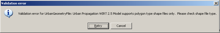
- The shapefile type must be Polygon, PolygonM, PolygonZ, or PolygonZM (the MultiPatch type is not supported).
- Projection must be Geographic (also known as Lat-Lon).
- Horizontal datum must be referenced to WGS84.
- Shapefiles must include an elevation attribute field with building elevations. You will need to know the attribute’s properties, in particular:
- Field name.
- Units. Either feet or meters are allowed.
- Vertical reference. Either height above mean sea level (MSL) or height above terrain are allowed.
The STK Urban Propagation Model does not support UTM coordinate-based geometry shape files.
For information on verifying the validity of a shapefile, see Verifying Validity of Shapefile Using ArcGIS or Verifying Validity of Shapefile Using Global Mapper.
Understanding the Shapefile
A shapefile is a set of three binary files and a *.prj file. The *.prj file is a text file that contains the shapefile metadata. The shapefile data format (binary data building geometry file) must be consistent with the metadata description in the *.prj file. STK may not be able to process the building geometry data if the data in all the files are not consistent. Converting the file data to a WGS-84 format and creating a metadata file may help to load the shapefile data into STK. Note that STK will import building geometry data from files with the latitude/longitude format on the WGS-84 reference frame.
Polygon or PolygonM
This is the preferred shapefile type for use with the Urban Propagation Extension. This type uses X-Y geometry to capture the building footprints and it relies on the elevation attribute to extrude the buildings. Although this geometry is planar, it can drape over uneven terrain and correctly extrude buildings
PolygonZ and PolygonZM
These shapefile types may require some additional work compared to Polygon or PolygonM shapefiles. This type uses an X-Y-Z geometry to define the building footprints and it similarly relies on the elevation attribute to extrude the buildings. These shapefiles can be authored according to various conventions and you need to understand how they are defined.
The Z geometry introduces some complexity and it is important to understand how it is interpreted by the Urban Propagation Extension. For building elevations, the analysis engine relies on the elevation attribute alone and ignores the Z geometry values. In that sense, it is as if the file was a regular Polygon type. Graphically, however, the Z geometry is not ignored, so you may have a gap where the building is being analyzed and where it is being drawn in the 3D environment. To mimic how the Z geometry is ignored in the analysis, consider the following graphics workarounds:
- Go to 3D Graphics Details properties page and re-specify the definitions for heights and bases of the buildings.
- Edit the shapefile and ensure that the Z geometry is universally set to zero. Keep the elevation attribute intact.
- Edit the shapefile and remove the Z geometry. This effectively converts the file from a PolygonZ type to a Polygon type. Keep the elevation attribute intact.
Verifying Validity of Shapefile Using ArcGIS
If you have ArcGIS, do the following to verify whether your shapefile meets the requirements:
- Open the shapefile in ArcGIS.
- In the table of contents, open the attribute table for the shapefile. The property under the Shape column must be either Polygon, PolygonM, PolygonZ, or PolygonZM.
- In the same attribute table, look for an attribute field that represents building elevations. The elevation values must be in feet or meters (you need to know the unit in which the elevation values are specified).
- Open the properties panel for the shapefile and go to the Source tab. The Geographic Coordinate System property must be either UTM or Geographic. The Datum property must be WGS84.
Verifying Validity of Shapefile Using Global Mapper
If you have Global Mapper, do the following to verify whether your shapefile meets the requirements.
- Open the shapefile in Global Mapper.
- Click FEATURE INFO TOOL and click a feature in the map. The Attribute Column must have a field for building elevations. The elevation values can be in feet or meters (you need to know the unit in which the elevation values are specified).
- Click OPEN CONTROL CENTER, select your shapefile name and click Metadata….
- AREA COUNT determines the number of polygons. It must be non-zero. You cannot determine whether the shapefile type is MultiPatch with Global Mapper; but if it is, you will get a warning with the Urban Propagation Extension.
- PROJ_DESC must be either "Geographic (Lat/Lon) / WGS84 / arc degrees" or "UTM / WGS84 / meters".
 Visit AGI.com